

MAP
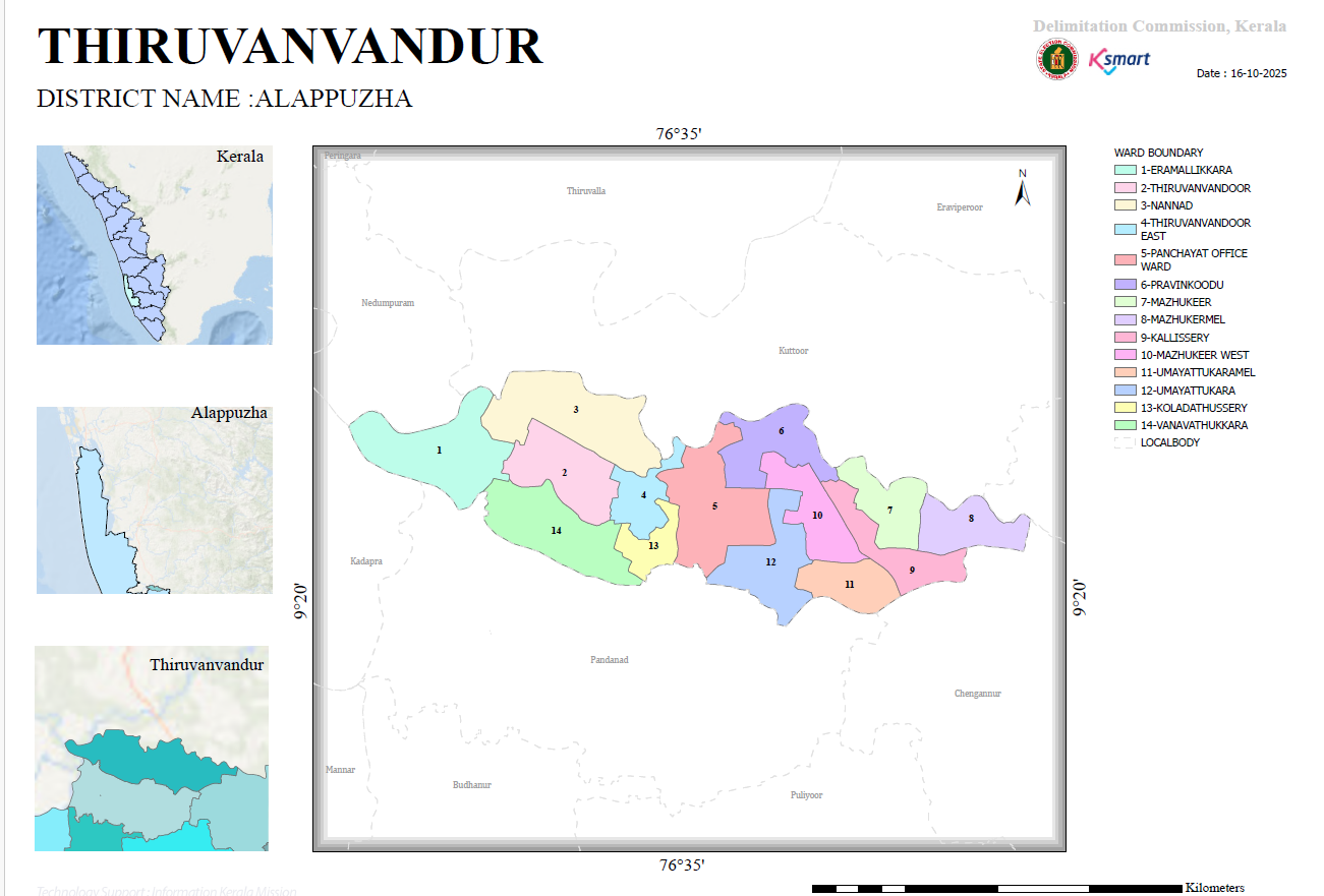
Thiruvanvandoor Grama Panchayat – Ward Delimitation Map
This image is the ward boundary map of Thiruvanvandoor Grama Panchayat. It is a ward delimitation map prepared by the Delimitation Commission of Kerala. The map clearly depicts the geographical location of the Panchayat, ward boundaries, ward numbers, and ward names.
Key Information
- District: Alappuzha
- Panchayat: Thiruvanvandoor
- Map Date: 16-10-2025
- Total Number of Wards: 14
- Each ward is represented using a distinct color.
- Ward boundaries and ward numbers are clearly marked.
- The map includes a north direction indicator and a kilometer scale.
List of Wards
- Eramallikkara
- Thiruvanvandoor
- Nannad
- Thiruvanvandoor East
- Panchayat Office Ward
- Pravinkoodu
- Mazhukkeer
- Mazhukremel
- Kallissery
- Mazhuker West
- Umayattukaramel
- Umayattukara
- Koladathussery
- Vanavathukkara
Geographical Analysis
- The wards are more densely distributed in the central part of the Panchayat.
- Wards 1 and 14, located in the western region, appear to cover comparatively larger areas.
- Wards 7, 8, and 9 are spread across the eastern region.
- Ward 5 (Panchayat Office Ward) is situated in the central part of the Panchayat.
- The ward boundaries have been delineated considering administrative convenience and effective local representation.
Map Structure
Three inset maps are provided on the left side of the image:
- The location of the Panchayat within Kerala State.
- The location of the Panchayat within Alappuzha District.
- The local geographical position of the Panchayat.
These inset maps help in understanding the geographical context and location of the Panchayat more clearly.
Conclusion
This map is an official document illustrating the administrative division of Thiruvanvandoor Grama Panchayat into 14 wards. It serves as a useful reference for understanding ward locations, boundaries, numbering, and the spatial distribution of the Panchayat. The map can be effectively utilized for local self-government elections, development planning, demographic studies, and administrative purposes.